NTSB Update Cites New Altitude Information
Latest summation details source of altitude data.
Credit: National Transportation Safety Board
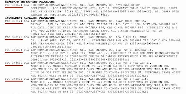
The National Transportation Safety Board (NTSB) Investigative Update for Feb. 4 reports that most recent information shows the Army Black Hawk helicopter altitude displayed in the control tower showed 300 feet at the moment of impact. However, that readout is rounded to the nearest 100 feet, the NTSB said, suggesting the helicopter altitude could have been as low as 251 feet, per that data.
According to the NTSB statement "the air traffic control tower display at DCA is fed by the Potomac TRACON. The TRACON fuses information from multiple radar sensors and ADS-B data, providing the best quality flight track data to air traffic control.” Additional data points from the Black Hawk’s onboard instrumentation are needed to verify the altitude information, the NTSB said. Recovering the Black Hawk wreckage to obtain further data is expected to occur later this week. Synchronizing available information from the Black Hawk’s flight data recorder (FDR) and cockpit voice recorder (CVR) is ongoing, as is the effort to transcribe audio from the cockpit voice recorders from both aircraft.
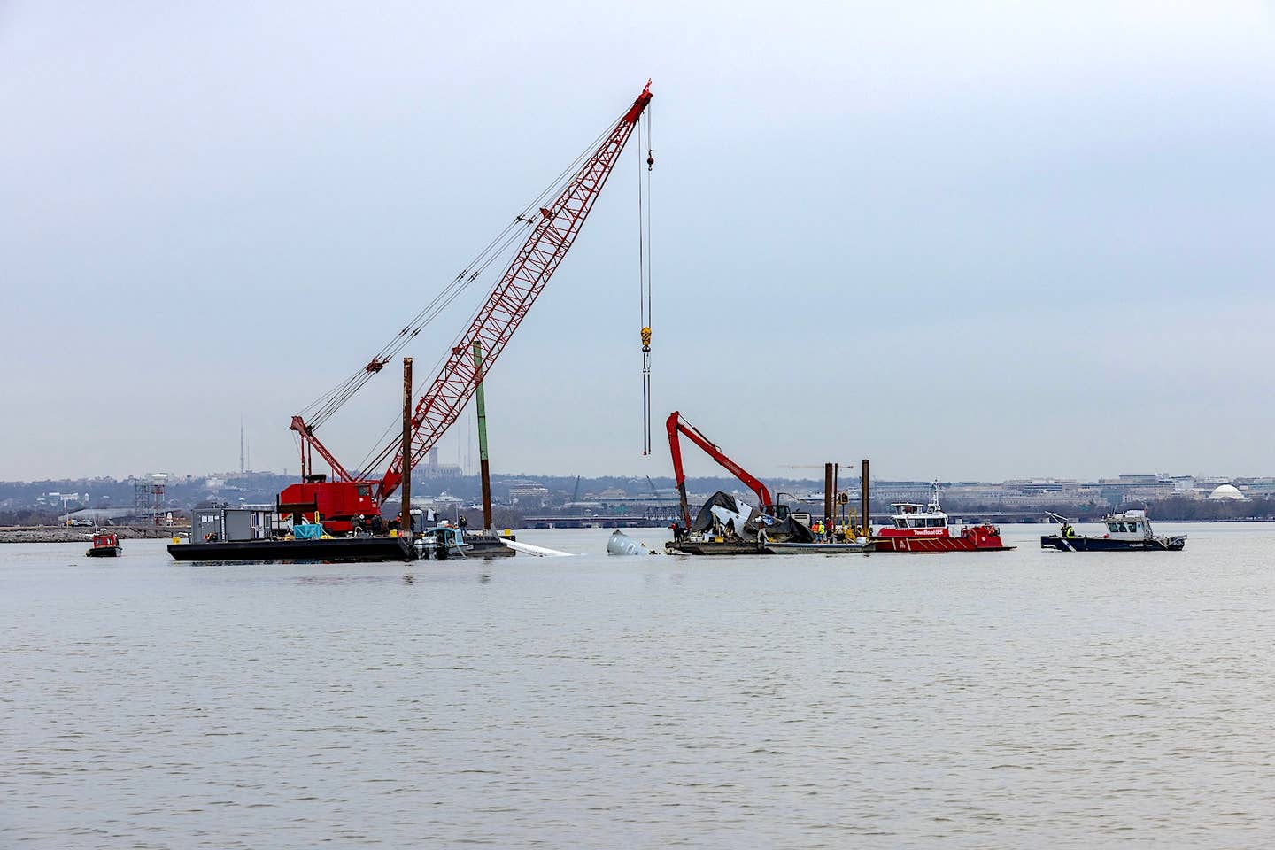
In bittersweet news, officials reported this evening that the remains of all 67 on board both aircraft have been recovered. Earlier today, the CRJ’s right wing, center fuselage, part of the left wing and left fuselage, significant portions of the forward cabin and cockpit, vertical stabilizer, tail cone, rudder, elevators, TCAS computer, and quick access recorder had been recovered and will be moved to a secure location for examination. The wreckage of both aircraft was found in roughly 8 feet of water in the center of the Potomac River.