I promised my private pilot student, Ned, a surprise for today's dual cross-country. He did not expect it to be a journey back to the time of flying dinosaurs.
I enjoy teaching him the ins and outs of flying because he always shows up prepared for the flight or at least tries to show up prepared. I am not sure he was ready for what we would do today.
Ned, I said, this morning we will turn on the way-back machine to 1950. My vintage Cessna 140 that we will fly is not an antique today. It represents the cutting edge of mid-twentieth-century flight. Heck, it even has one of those newfangled electrical motor starters!
My student sat at the briefing picnic table outside my T-hangar and, with a "humph," laid out the sectional chart, the dead reckoning planning chart, and his solar/battery-powered flight computer calculator thingy.
"Oh great," he said. "Are you going to try to teach me how to use that giant E6B you have on your tool table?"
Nope, I said. I don't want to take you away from your ones and zeros powered by the sun. After this flight, you can return to the twenty-first century. Today, we will use our noodles, pencils, paper, and some old-time navigation tricks taught to me by the ancient masters.
Ned had meticulously prepared his cross country, and I hated to throw that work away. Still, I gave him a new destination near enough to the original to allow him to retain the winds aloft and the weather briefing from his original plan.
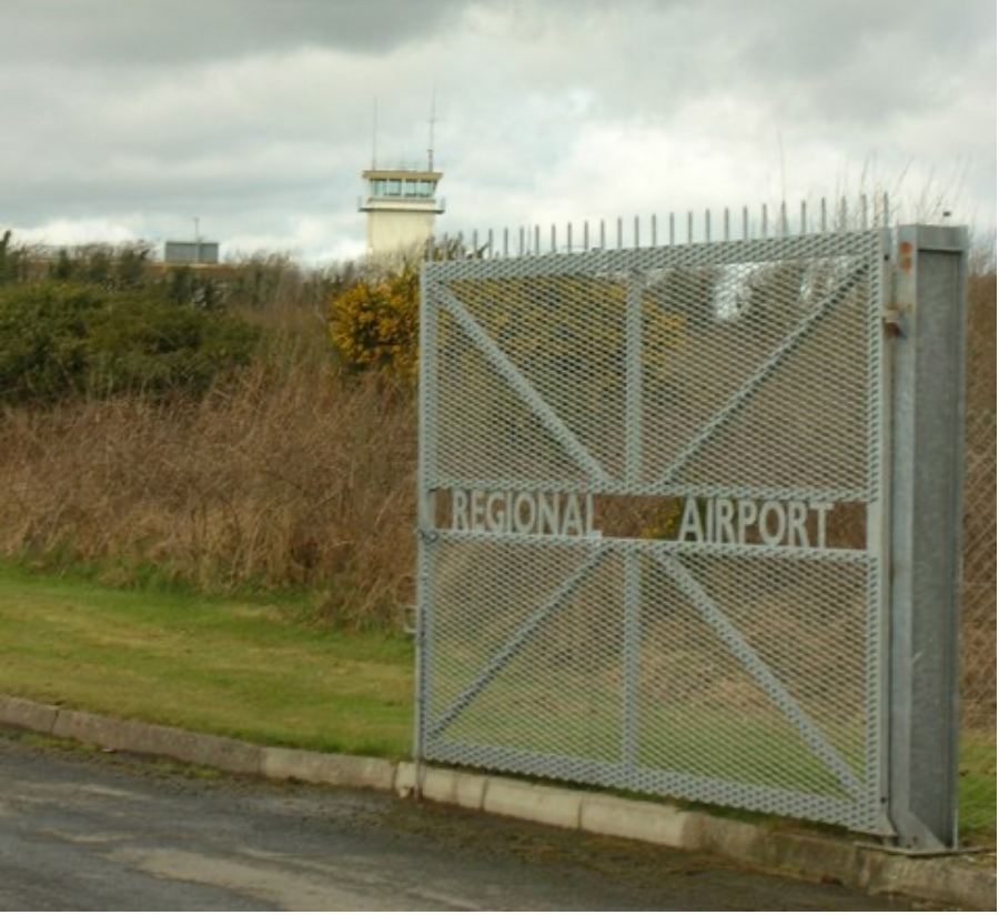
I should mention that we were no longer going to a controlled, paved runway airport. We were heading to a grass strip nestled in the hills of Eastern Kentucky.
There is no ATIS, AWOS, Unicom, multi-com, or any kind of com. If it hasn't blown away during last week's storms, I think the place has a windsock.
Ned and I got a long ruler, some pencils, a pad of paper, and a plotter that my dear old flight instructor Jesse Hinson lent me in 1973 that I never returned.
He plotted a wind triangle without using the wind side of any flight computer. He then worked through variation and deviation and calculated his various groundspeeds with nothing but a pencil and a brain. Ned noted on the chart the times he calculated he would pass various obvious visual clues on the chart that he chose as checkpoints.
Our comm radio would remain in the "Oscar-fox-fox" position, creating a heightened awareness of the outside VFR world and its traffic. Our transponder and ADS-B would be left to help controllers, but we would leave our Stratus and iPads in our flight bags for use only in emergencies.
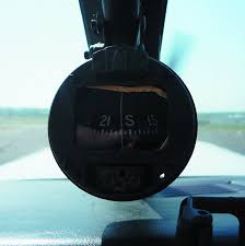
We then launched the mighty 140 into the windy-bumpy conditions you often find on a clear day. As he took up his first heading, I pulled out my sticky instrument covers and concealed the electronic artificial horizon and directional gyro on the plane's panel. No gyros today, Ned.
Relying on a magnetic compass with all its known "east is least, west is best" and "accelerate north, decelerate south" issues, Ned followed his plan. He managed to find our destination airport with only his paper chart, the panel clock, and a leaky whiskey compass.
It wasn't easy for Ned, and I could see he was a little nervous. Like most of us, he was used to consulting a computer every few minutes for vital, accurate information. I was returning him, at least for a day, to an era when getting where you wanted to go was an analog endeavor fraught with the chances of unforecast winds and weather.
The grass field we landed at had many advantages, not the least of which was a picnic table under a shady tree and a decent restroom. We sat, ate our packed snacks, and had a short mid-lesson chat.
Ned was feeling his navigational oats. "Wow," he said. "That was kind of challenging and fun, but I wonder how important dead reckoning is in the GPS world. Even my wristwatch would tell me where we were if you hadn't taken it away."
Maybe this very basic navigation training is not that important, but maybe it is. I am not crusty enough to suggest that someday when all the electronic navigation aids go belly-up, this training will save your bacon. Personally, I always carry a GPS of some sort and rely on it for the great information it can provide—especially in a high-traffic area.
With today's plethora of TFRs and other restricted airspace, getting help from your electronic buddies is an inexpensive no-brainer.
Look at today's cross-country as a grounding in the basics. Almost every endeavor, if taught properly, begins with the fundamentals. You can only appreciate calculating and using a magnetic course if you have done it in the real world and seen that airport appear where and when it should.
Think of our lesson today as baking a cake from scratch or sending a handwritten letter with a stamp through the mail. Are you ready to get back in the air and enjoy your next surprise?
Ned gave me a nervous nod as I reached into my bag and tossed him a 2024 paper Triple-A Road Atlas. Yes, they exist, and I carry one in my plane.
We are going to fly over this little town twenty miles west and then head home using nothing but your eyeballs and this paper map, I said
You can look at the whiskey compass if you like, but I suggest you get ready to read water towers, follow railroad tracks, and catch a glimpse of the more prominent road signs.
We are going back to modern times via pilotage, baby!