
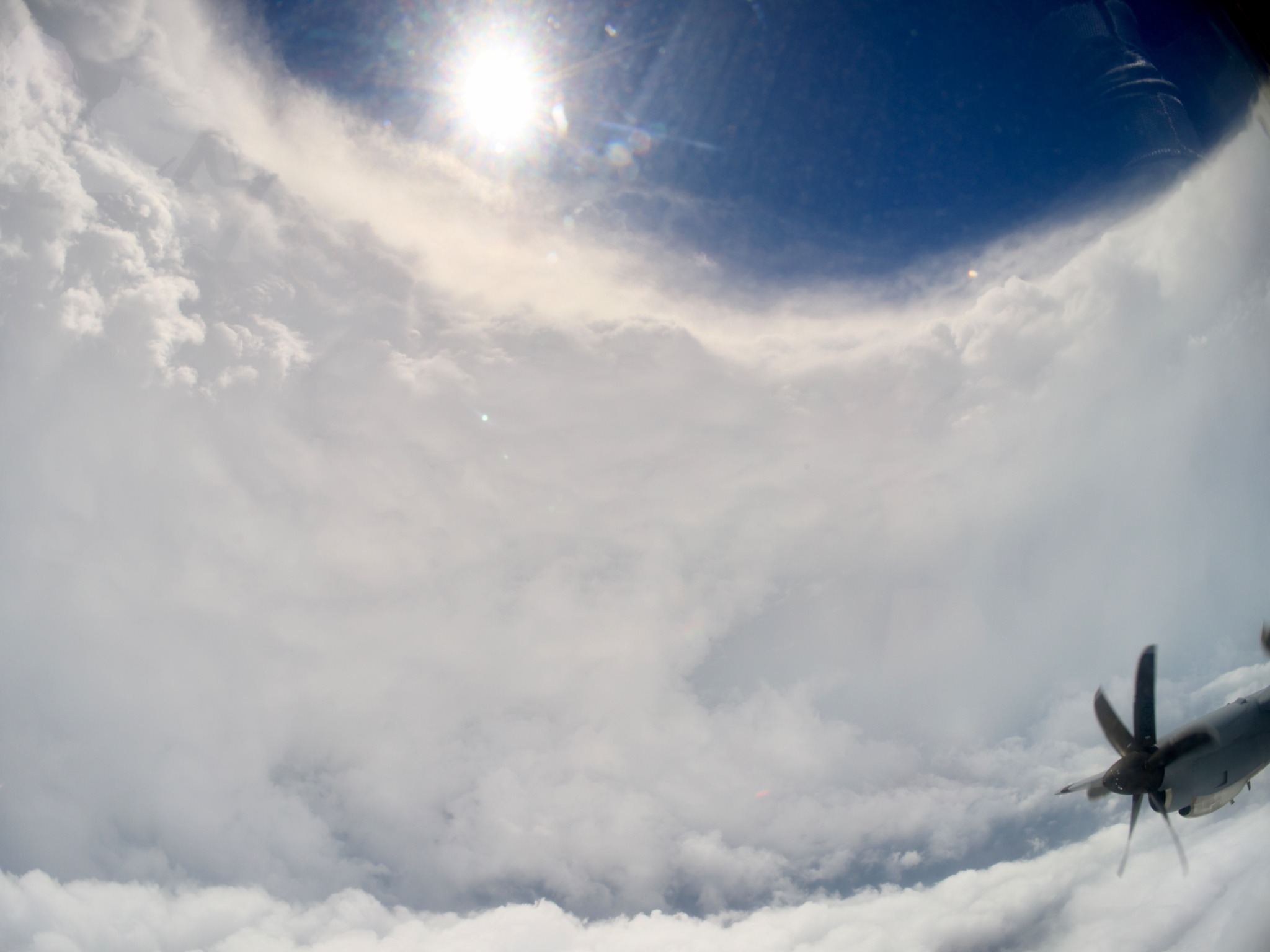
New video from a crew member aboard a U.S. Air Force WC-130J “Hurricane Hunter” shared via X shows the aircraft slicing through the eye of Category 5 Hurricane Melissa, which is now striking Jamaica with catastrophic winds and flooding. These flights gather real-time meteorological data for the National Hurricane Center.
Third pass through Melissa. GoPro in side window as different camera looking forward shooting in ultra high res 8k. Not sure when that might get processed as the file turned out ridiculous. Barely had HD space for it and MacBook Pro promptly chocked when I tried to edit it pic.twitter.com/3p430gPvZv
— Tropical Cowboy of Danger (@FlynonymousWX) October 27, 2025
Melissa’s near-perfect eye features winds exceeding 180 mph and a central pressure of 892 millibars, making it one of the most powerful Atlantic hurricanes on record, according to CNN.
The storm arrived to southern Jamaica Tuesday morning with sustained winds up to 185 mph and torrential rainfall exceeding 30 inches in some regions. Storm surges were as high as 13 feet. Jamaica’s climate minister called the risk of flooding “extreme,” as more than 800 shelters opened nationwide to house residents displaced by the storm.
Both NOAA and USAF hurricane hunter have now had to return early from missions in #Melissa due to turbulence over the past few days. That says volumes about the intensity of this storm. https://t.co/Eu0cbTh876 https://t.co/yXTd9giw7y pic.twitter.com/Jl7aBX98xX
— Flightradar24 (@flightradar24) October 28, 2025
The video comes from flights conducted by the U.S. Air Force. The 53rd Weather Reconnaissance Squadron, based at Keesler Air Force Base in Mississippi, flies the WC-130J Super Hercules “Hurricane Hunter.” The aircraft makes multiple passes through tropical systems to measure wind, temperature, pressure and humidity. Each Hurricane Hunter mission provides data that aims to improve hurricane forecasts and help coastal communities prepare. The squadron’s legacy dates back to 1943, when a U.S. Army Air Corps pilot first dared to fly through a hurricane—a practice that continues today, even amid storms as fierce as Melissa.


Many years ago flying HKG-SFO in a B744 aware that Typhoon Zelda was on the loose, as we crossed Taipei at FL 350 my F/O remarked that night was coming early, my reply no, this is Zelda. 150nm across, tops just below us , only moderate turbulence, white caps on our coffee,nothing worse, our FMS showed W/V going from 150kts on the nose to much the same on the tail within 100nms along track. Nobody died, or even spilt their drinks in First Class, nobody asked about the 300 souls in Economy . Never met a Zelda in the flesh, once was enough. Yours aye, Mac