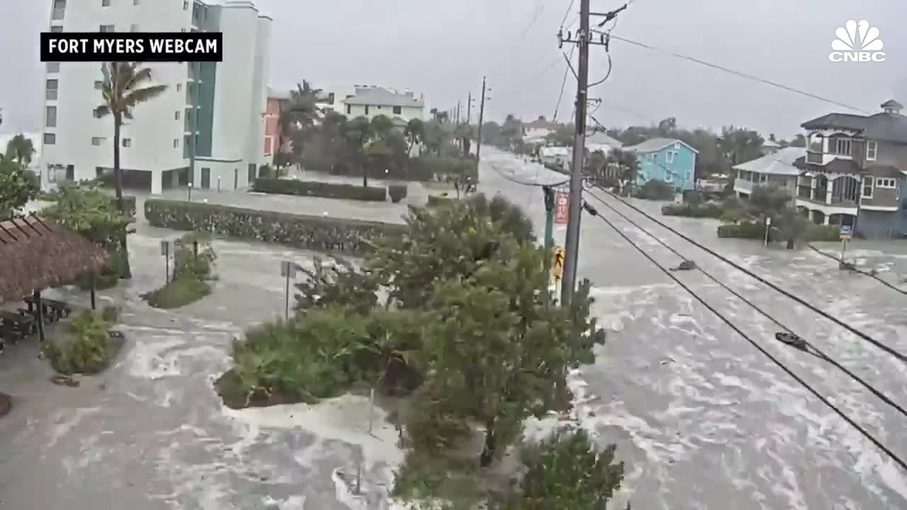
As with real estate, with hurricanes and airports, location is everything. This security camera footage from Ft. Myers, Florida, during Hurricane Ian on Sept. 28 obtained by CNBC dramatically shows how fast storm surge can inundate normally dry land. Ft. Myers and Naples were, unluckily, located on the southern eyewall of Ian as it came ashore. This pushed water from the Gulf and bays onto the mainland, creating record levels of flooding. Although Naples Airport is protected by a barrier island, the onshore wind drove the bay’s water completely over the airport, whose elevation is 6 feet. Further north, as mentioned in this week’s blog, Venice Airport benefited from being in the northern outer eyewall. The winds were out of the east, pushing the water away from the airport, which is about 12 feet above sea level. As of Sunday, both airports had reopened.
What Fast Moving Storm Surge Looks Like
Key Takeaways:
- Location was the critical factor during Hurricane Ian, with Ft. Myers and Naples experiencing dramatic, record-level storm surge and flooding due to their position on the southern eyewall.
- Naples Airport, with a 6-foot elevation, was completely inundated by storm surge, despite a barrier island, while Venice Airport at 12 feet above sea level benefited from offshore winds in the northern outer eyewall.
- The article emphasizes that an airport's specific location relative to a hurricane's eyewall dictates the direction of water movement and the resulting severity of flooding.
See a mistake? Contact us.