
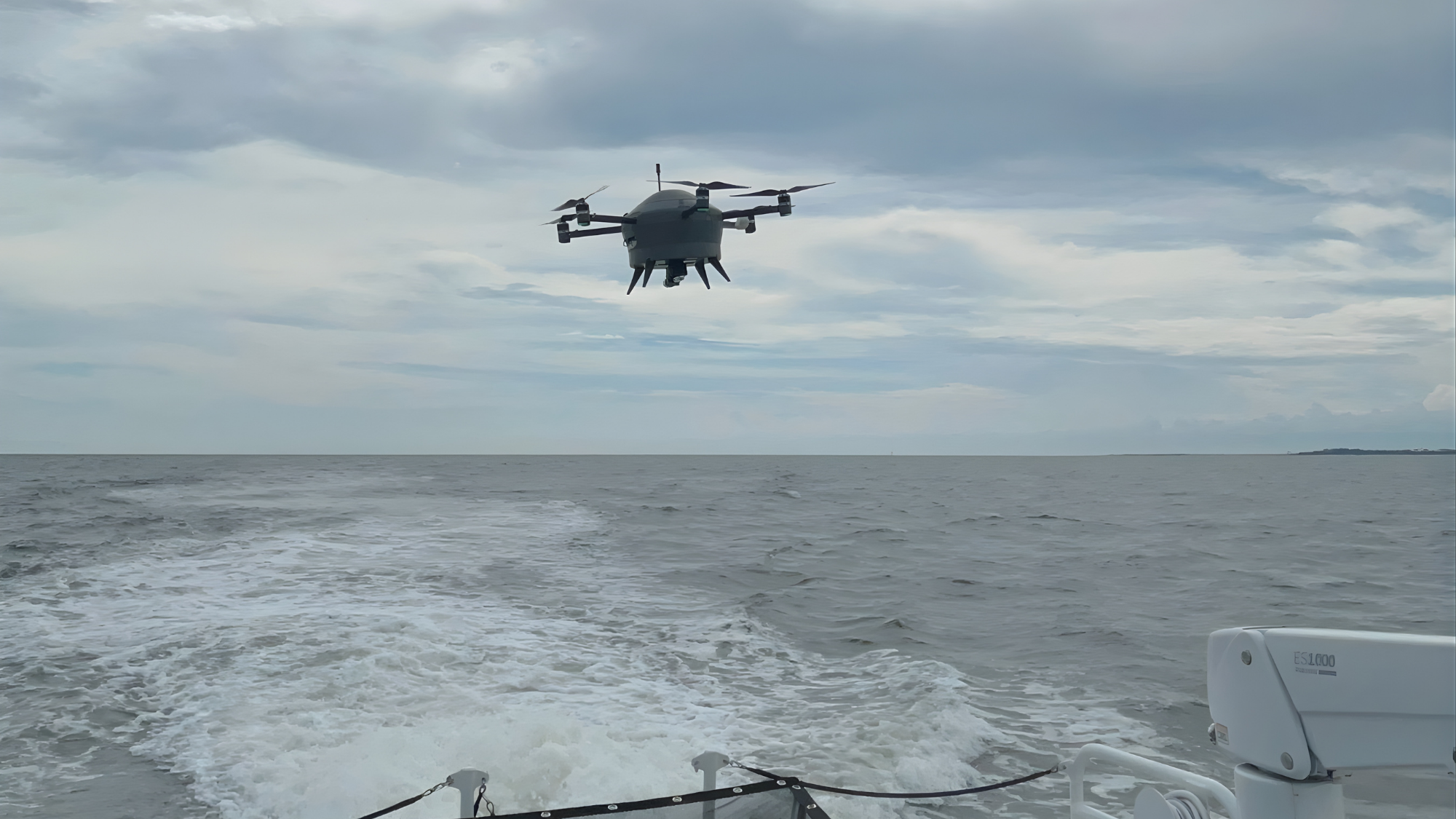
Weather intelligence company Meteomatics said Thursday that it has partnered with the U.S. Navy to test automated drones for gathering atmospheric data during maritime operations. The trial, held as part of the Advanced Naval Technology Exercise in the Mississippi Sound near Gulfport, Mississippi, evaluated whether the drones could launch from and return to a moving vessel. Meteomatics said the drones are intended to solve longstanding challenges in collecting localized, high-resolution weather information at sea.
Challenges collecting weather data at sea
Navy officials noted that gathering detailed atmospheric information over open water has long posed significant challenges. Weather balloons, for instance, are not always practical aboard moving ships, while satellite data cannot offer complete vertical resolution.
“For the last decade, U.S. military weather services have sought to consistently and reliably measure the atmosphere over the open ocean to improve forecast accuracy and identify atmospheric anomalies,” Kevin Lacroix, Weather Services Technology Lead, Naval Meteorology and Oceanography Command, said. “Products with the capability to collect-high resolution, real-time atmospheric data, repeatedly, in environments of interest are valuable to military weather services for sensing the maritime boundary layer of the atmosphere.”
U.S. Navy tests
During the demonstration, Meteodrones operated under FAA regulations and recorded vertical profiles of temperature, humidity, pressure, dew point and wind. Multiple flights were conducted at vessel speeds between 1.5 knots and 16 knots, and the drones returned for recovery after each run.
According to Meteomatics, the real-time observations collected during the test can support mission planning by providing additional insight into atmospheric conditions that influence flight operations and radar performance. Lacroix said the information could also be used to support electromagnetic tactical decision aids aboard ships.
Brad Guay, Head of Government & Defense Solutions at Meteomatics, said the trial demonstrated the system’s ability to conduct launches and recoveries from a moving vessel, adding that the company plans to continue working with the Navy on potential future capabilities.


0 replies