
The National Weather Service’s Alaska Aviation Weather Unit will implement updates to its Surface and Significant Weather charts beginning Feb. 22, including changes to chart appearance, resolution and production methods. Changes to the charts were proposed last year.
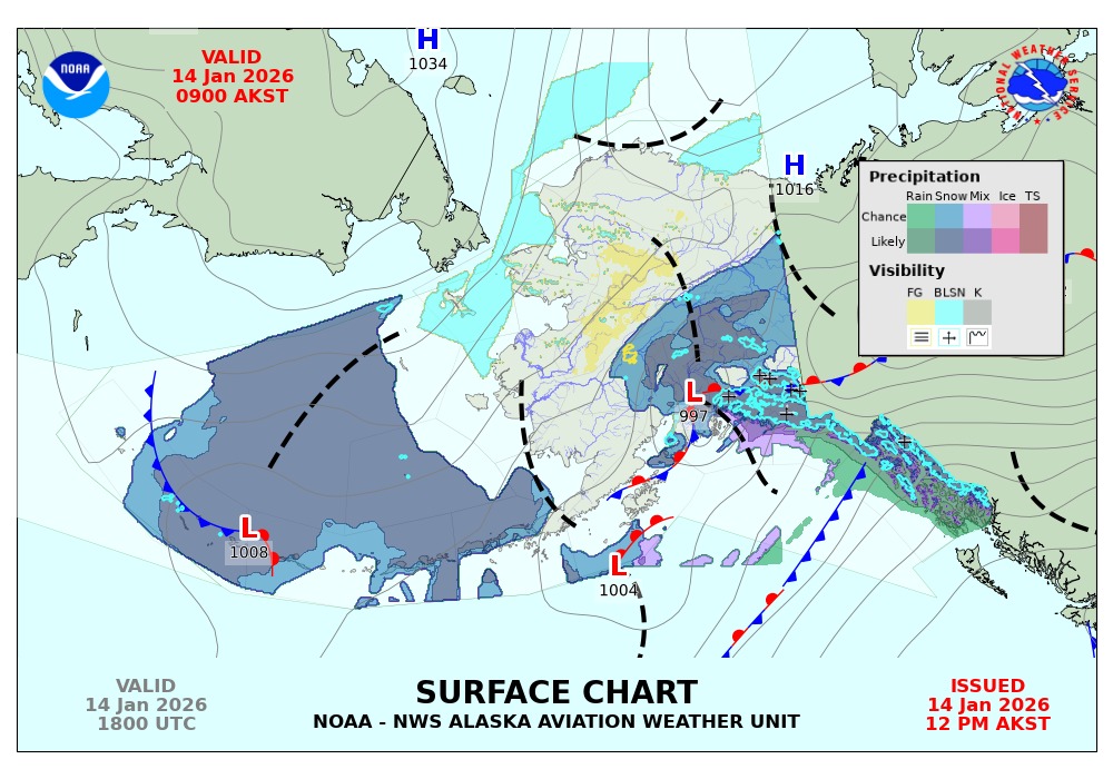
According to a National Weather Service Service Change Notice, the revised Surface chart will incorporate higher-resolution data, probabilistic precipitation information and improved consistency with other NWS products while transitioning production off a legacy system. Surface charts will continue to be issued four times daily at 00z, 06z, 12z and 18z, and file formats will change from GIF to PNG.
The Significant Weather chart will retain existing forecast elements such as flight categories, turbulence and freezing levels, but will no longer include frontal boundaries. Forecast frontal information will remain available through Ocean Prediction Center Alaska/Arctic analysis and graphical products, which will continue to be linked on the unit’s website. Significant Weather charts will continue to be produced twice daily, providing forecasts from 24 to 60 hours, also transitioning to PNG image files.
In a National Weather Service video outlining the changes, warning coordination meteorologist David Kochevar said the updates are intended to align chart content with other agency products and data sources.
“This will be the same data that you can currently get on GFA graphical forecast for aviation that will allow you to zoom in and out and get better quality, higher resolution data for your particular area,” Kochevar said in the video.
Examples of the updated charts and additional information are available on the Alaska Aviation Weather Unit website.


0 replies