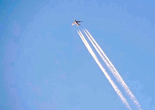
The virtual explosion of applications for using artificial intelligence (AI) could soon include minimizing aircraft condensation trails, the cloud-like results of high-altitude moisture meeting the disruptive churning of jet engines and/or aircraft wake turbulence. “Contrails” (not to be confused with the controversial concept known as “chemtrails”) have been shown to contribute as much as 35% of aviation’s climate impact by creating clouds that trap greenhouse gases that otherwise would dissipate into space.
According to Britannica, “A contrail forms when water vapor produced by the combustion of fuel in airplane engines condenses upon soot particles or sulfur aerosols in the plane’s exhaust. When the ambient relative humidity is high, the resulting ice-crystal plume may last several hours.” And not all contrails are harmful. Jill Blickstein, VP of sustainability at American Airlines, told CBS, “A contrail could form and then just dissipate, but the contrails that persist can be very warming.”
Based on a study involving American, Google and the Bill Gates-created Breakthrough Energy organization, AI-generated contrail forecast maps could enable pilots to alter course and/or altitude and reduce the overall greenhouse effect of contrails by as much as half, worldwide. The maps are generated using satellite imagery, weather data and flight path information to identify which flights are most likely to generate the worst contrails.
More than 70 test flights in the first half of last year showed that predictions of contrail-vulnerable conditions could enable pilots to make slight adjustments in course or altitude. Blickstein said a change of as little as 2,000 feet up or down could do the trick. “What the test showed is that you could use the predictions to avoid creating a contrail,” she said.
It’s a technique that was well known to American F-86 Sabrejet pilots during the Korean War, but for a different reason. For a fighter pilot, altitude is the “high ground” when entering a combat zone—the higher the better. But generating contrails alerted enemy pilots from miles away. So while still in safe airspace, the Sabre pilots would climb until they started generating contrails, then reduce altitude until the telltale plumes dissipated.